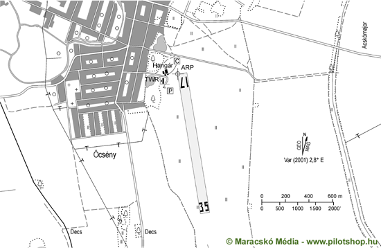
Airfield
Airfield data
Village name: Ocseny
ICAO code: LHOY
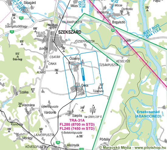
Position: 6 km / 3 nm SE Szekszárd
Geographical coordinates: N461843 – E0184550 – WGS84
Elevation: 90 m / 295 ft
Callsign: Ocseny RADIO
Frequency: 122,835 MHz
Traffic pattern: LH, RH
Category: Non public take-off and landing ground
Operating hours: SR-SS (from sunrise to sunset)
NVFR: Nil
IFR: Nil
RWY: 17/35
Runway dimensions: 1260 x 150 m
Surface: Grass
TORA: 1260 x 150 m
LDA: 1260 X 150 m
Load: 22/15
Lights: Nil
Remarks
1. Only day VFR flight allowed
2. The airfield can only be used with the authorisation of the owner or operator except when aircrafts are in emergency situations.
Airfield Rules
Operator
Multifly
Location: Repülőtér, Őcsény, H-7143
E-mail: sales@multifly.hu
Web: multifly.aero
OPS: +36 30 197 9142
Weather info: Nil
Customs: Nil
Fuel: Nil
Visual Approach Chart
Ground Movement Chart